- Revenue Collection
- GIS & Mapping
- Government Technology
- Mobile Apps
Taxpayer and Property Enumeration Apps: How to Find Who Owes What
You can't collect from people who aren't on your list. How mobile enumeration apps use GPS, photos and satellite maps to build an accurate register of properties and businesses.
 Arsalan Sadiq 5 min read

You can't collect from someone who isn't on your list.
It sounds obvious, but it's the most common reason revenue programmes underperform. The collection app works, the officers are diligent, and yet a large share of the properties and businesses in the area have never received a bill, because the register is years out of date or never existed.
Enumeration is the work of finding everyone who should be paying and recording them properly. A good mobile app makes it faster, more accurate and much harder to fake.
What the numbers say
Two programmes show how much is at stake:
- In Freetown, Sierra Leone, a property tax reform supported by researchers and the city used satellite imagery, field discovery and a digital platform to rebuild the property register. The number of registered properties rose from about 57,000 to over 109,000, nearly doubling the tax base.
- In Ghana, the dLRev system developed with GIZ and adopted by the government for district assemblies cut field data collection from roughly 120 person-days to 20 person-days per 10,000 parcels.
Neither result came from a better payment screen. They came from knowing who and what was there.
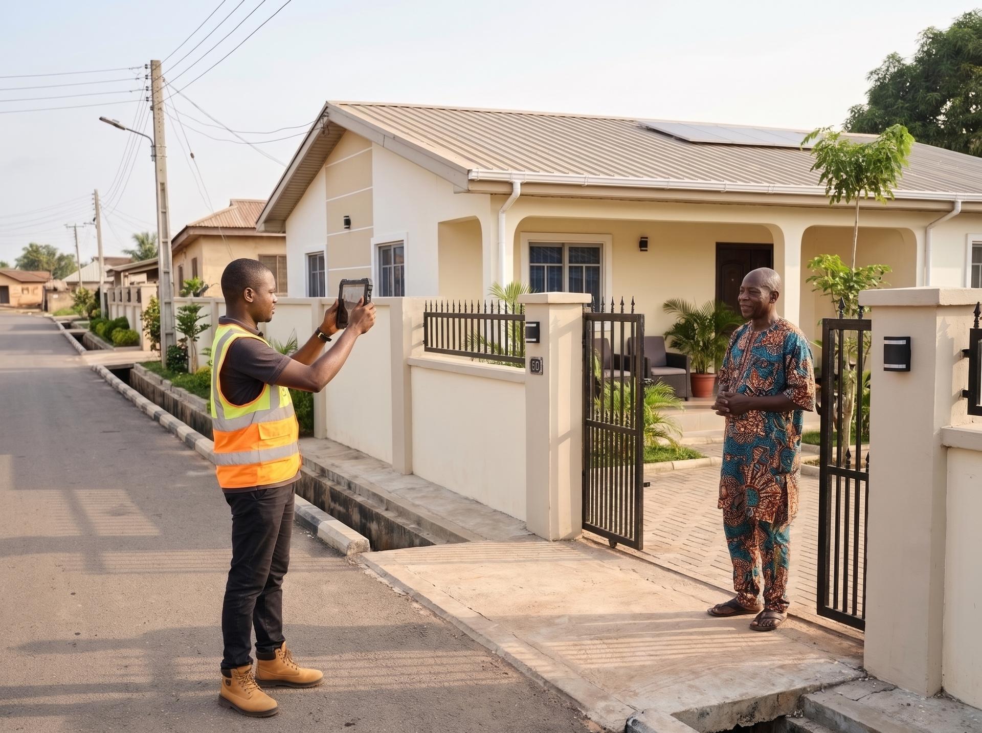
What an enumeration app records
Keep the form short. Every extra field slows down the officer and lowers data quality. A practical core:
| Field | Why it matters |
|---|---|
| Unique ID | One identifier for the life of the property or business, printed on a plate or sticker |
| GPS location | Captured automatically, with the accuracy reading stored alongside it |
| Photos | Front of the property, plus the signboard for businesses |
| Category | Residential, commercial, mixed, market stall, kiosk and so on |
| Simple attributes | Floors, size band, building material, connected to water or power |
| Occupant or owner contact | Name and phone number, for bills and SMS receipts |
| Visit status | Recorded, owner absent, refused, under construction, vacant |
The attributes feed valuation. Many cities now use simple points-based valuation (so many points for size, location and quality), which needs consistent data more than precise data.
Addresses where there are no addresses
Many neighbourhoods have no street names or house numbers, which is exactly why registers fall out of date. Three practical answers:
- Location codes. Open Location Code (Plus Codes) turns any GPS point into a short code anyone can use, free and without a licence.
- Physical plates. Fix a numbered plate or QR sticker to each property during enumeration. The next officer scans it instead of searching.
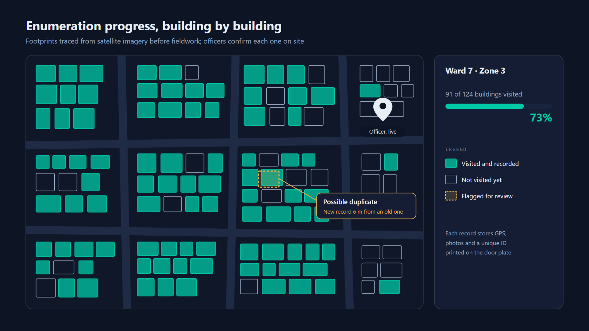
- Building footprints. Trace building outlines from satellite imagery before fieldwork, so officers confirm buildings on a map instead of discovering them on foot.
Lagos is moving in this direction with a state-wide digital house numbering project, partly to bring undocumented properties into the tax net.
The workflow, start to finish
- Prepare the map. Load satellite imagery and building footprints for each ward. Split it into zones of a size one officer can cover in a set number of days.
- Download for offline use. Officers carry their zone's map tiles and footprints on the device, because enumeration happens in the places with the worst coverage.
- Visit and record. The officer taps a footprint, fills the short form, takes photos and fixes the plate. Unvisited footprints stay highlighted until they're done.
- Check quality. Supervisors re-visit a random sample, often around 5 percent, and compare results.
- Value and bill. Back-office staff apply the valuation rules and generate bills, which go back out to the collection app.
Keeping the data honest
Enumeration data is easy to fake from a desk if the app allows it. Build in checks:
- Accuracy thresholds. Reject GPS readings with poor accuracy, and require the officer to be within a short distance of the footprint they're recording.
- Duplicate detection. Flag new records very close to existing ones with a similar name or category.
- Photo checks. Store photo time and location with each record, and flag records where they don't match the visit.
- Pace checks. Twenty properties recorded in ten minutes is a reason to look.
On a field service platform I led, we tracked crews and jobs on a live map using Leaflet and Google Maps. The biggest lesson from that work applies here too: maps make bad data visible. When supervisors can see where every record was captured, most problems are caught the same day.
The map stack
You don't need expensive software. A reliable, low-cost setup:
| Layer | Option |
|---|---|
| Base maps | OpenStreetMap tiles, or a commercial provider where licensing allows |
| Mobile map | Leaflet or MapLibre inside the app, with offline tile packs |
| Spatial database | PostgreSQL with PostGIS |
| Desktop GIS | QGIS for back-office editing and analysis, free and open source |
Privacy is part of the design
An enumeration register holds names, phone numbers, photos of homes and locations. That's personal data under Nigeria's Data Protection Act 2023, Kenya's Data Protection Act 2019, Ghana's Data Protection Act 2012, and, for Canadian municipalities, provincial privacy law. Collect only what you use, restrict who can see contact details, log every export, and tell people why you're collecting it. Trust also affects compliance: people are more willing to pay when they believe the register is fair and their data is safe.

Where enumeration fits
Enumeration feeds everything else. A clean register makes the collection app useful, makes leakage visible and gives you a realistic target. For the controls that stop money disappearing once it's collected, see 9 Controls Every Field Collection App Needs. For keeping the app working where coverage is weakest, see Offline-First Collection Apps.
Sources
- Reforming property tax valuation in Sierra Leone, International Growth Centre
- Sierra Leone impact case study (PDF), International Growth Centre
- Ghana Priorities: Digitization, Copenhagen Consensus Center
- Lagos digital house numbering, Techpoint Africa
- Lagos GIS mapping and house numbering to boost proptech adoption, Nairametrics, May 2026
Planning an enumeration exercise and wondering how much of it software can handle? Get in touch. I'm happy to talk it through.
Views here are my own and don't represent any current or past employer or client. This is general information, not professional advice for your situation. Full disclaimer
Working on something similar?
I help businesses and founders design and build software like this. Book a free call or send a few details about your project.